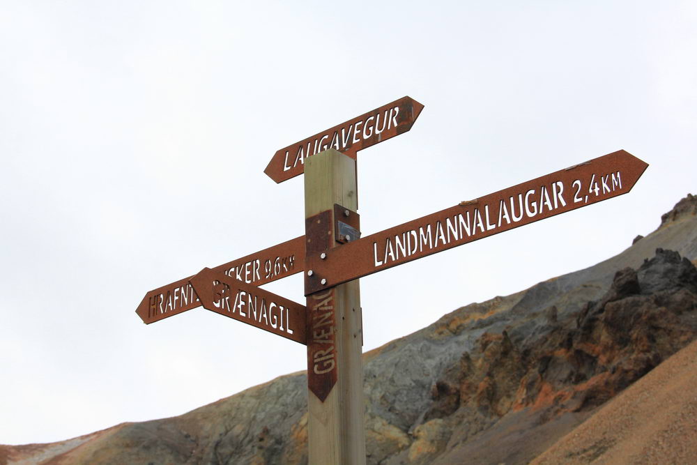
Laugavegur — the Icelandic hiking route. This route was included in the list of the "20 best hiking routes in the world" according to National Geographic. Laygavegur is located in the southwestern part of the country, has a length of about 55 km. The highest point on the way is 1050 m. The route passes through a wide variety of landscapes; Along the route you will encounter lava fields, hot springs, green fields of Icelandic moss, canyons, peaks and waterfalls.
The route usually takes from 2 to 4 days to complete. It is relatively easy to walk through Laygavegur, but at the same time the route is very picturesque, which is why it is popular with locals and tourists. The main difficulties may be with the weather. And so – along the detailed marked path there are not only campsites, but also several equipped houses, and, as a rule, even with showers and kitchens. They work from June 25 to early September, and at other times it is not recommended to travel the route at all. In any case, it is not worth booking accommodation at the last moment, and it is necessary to take sleeping bags with you. Any apparent inconveniences are compensated by the first ice cave encountered.
Content:
- Where to buy tickets and how to get there
- The main attractions on the route
- When is the best time to go on the Laugavegur route
- Route by day
- What is definitely worth taking on a hike
- Food on the route
- Laugavegur route map
Where to buy tickets and how to get there
Most often, the route starts from the north from the Colored Mountains and hot springs of Landmannalaugar, and ends in Torsmork: you can get there and back by bus from Reykjavik. The passage along the route is free if you go on your own. If you plan to go with a guide and a group, the prices vary greatly. For example, on the website of the aggregator of tours in Iceland, you can find both inexpensive tours with overnight stays in tents and more "fashionable" ones as far as possible in the wild.
If you still decide to go through this route yourself, then you still need to get to the start of the route. If you are lucky and you have a friend who is ready to bring you to the start of the route and then pick you up at the finish line in 3-4 days, then the problem is solved. But if not, then you will have to use the services of buses. Yes, you heard right, even in such remote and seemingly inhospitable areas in Iceland there are buses, but these are special four-wheel drive and powerful buses ready for all conditions. Tickets with arrival at one place and departure from another can be purchased, for example, on the Icelandic Excursions website.
You can read more about public transport here ->
Buses in Iceland, routes and schedules
The easiest and most popular way to travel around Iceland is to rent a car. But what if for some reason this option is not suitable for you?
Not many people kn...
The main attractions on the route
During the passage of the Laygavegur route, you will see:
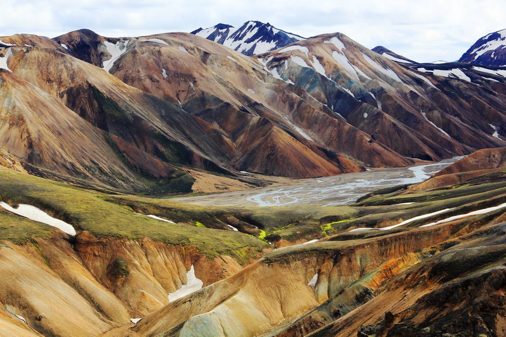
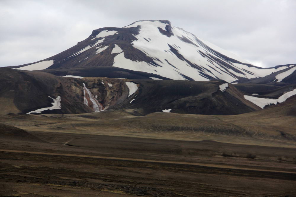
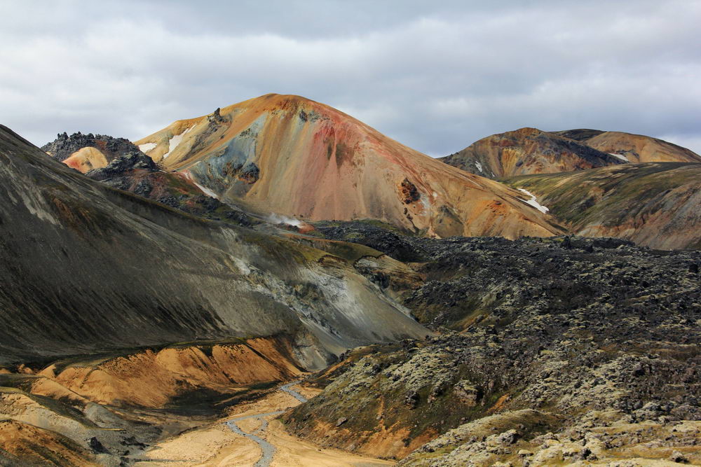
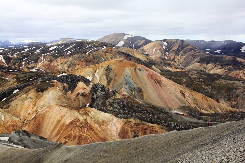
- Landmannalaugar is a valley where the colored mountains of Iceland are located, a place where you can't get to by an ordinary car, and the mountains are painted in yellow, red, green and other colors!
- Thorsmork Valley is a valley into which steep cliffs covered with green moss lead, and streams are chaotically scattered along the bottom of the valley among black sand
- Hot springs - if you have not yet bathed in wild hot springs, then you will succeed on this route. And for those who want to explore more hot springs, we have prepared article about the most interesting hot springs
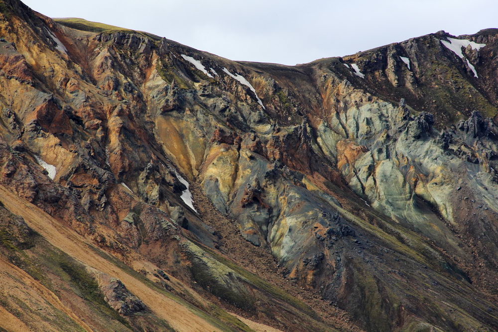
- Colored Rhyolite Mountains (Multicolor Rhyolite Mountains) - colored mountains, it is the mineral rhyolite that paints them in different colors
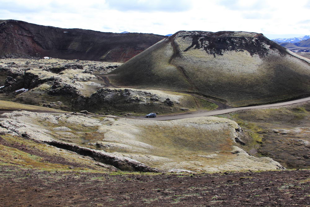
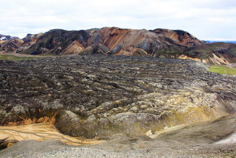
- Laugahraun Lava Field - endless lava fields, sometimes they are covered with moss, and sometimes completely black - it all depends on when the last eruption was
- Obsidian stone fields - Obsidian is a stone of volcanic origin, very sharp at the break, when obsidian knives were very appreciated
- Glaciers and Active volcanoes - there's not even much to say...
- Canyon Markarfjotsglufur (Markarfljótsgljúfur Canyon) is a canyon with steep walls where you can observe how the earth was formed here in layers
- Mount Brennisteinsalda (Mt. Brennisteinsalda) is one of the most colorful and most active smoking mountains in the Landmannalaugar Valley
When is the best time to go on the Laygavegur route
If you are not ready to overcome snow drifts and spend the night in the snow, then the best period for this route is from the end of June to mid-September. It is during this period that mountain shelters are open, and even if you spend the night in a tent, you will at least be able to warm up in the house in the kitchen and go to the toilet not for a stone.
Route by day
The Leugavegur route is only 55 kilometers, it can be run in one day (unless of course you are used to running long distances through the mountains), but usually it is completed in 3-4 days. You can do it faster, but then will there be time to enjoy all the beauties, and not just run past.
Day1
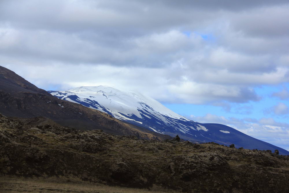
Drop-off to the beginning of the route and start. From Reykjavik to the Lanmannalaugar Valley, the journey takes 3-4 hours, first along the Southern coast of Iceland, and then along mountain roads past the Hekla volcano and its lava fields with several fords. By the way, Hekla is Iceland's most active volcano, erupting every 10-15 years over the last century.
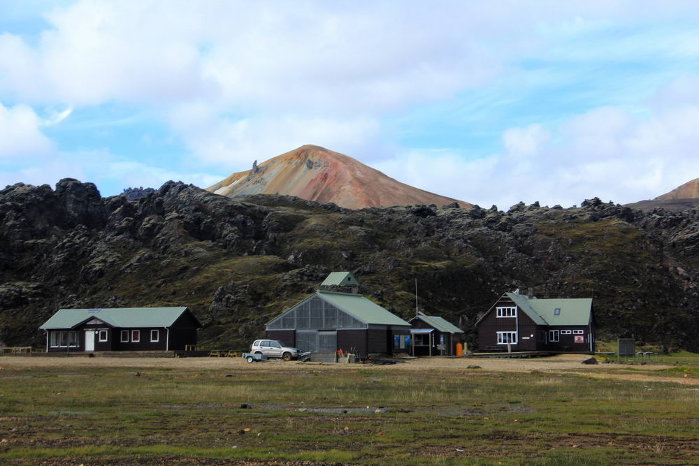
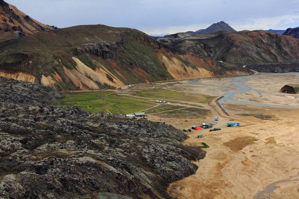
The Laygavegur trail begins at the geothermal oasis of Landmannalaugar or "People's Pools". There are many hot springs in this valley, and the valley itself is surrounded by picturesque rhyolite mountains. Right on the edge of Landmannalaugara are the coal-black lava fields of Laugaraun, a huge field of dried magma formed in 1477 during an eruption.
On the first day, you will climb Brennisteinsalda Mountain (wave of sulfur), the most colorful mountain in Iceland. The volcanic mountain is painted with black and blue lava and ash, green moss and red iron. Along the way, you will pass the steaming vents of the Stórihver"(big spring) hot spring and the black obsidian desert of Hrafntinnusker.
Overnight at the Hrafntinnusker or in a tent near the lodge
Distance: 12 km, travel time: 4-5 hours, climb: 470 m.
Day 2
On the second day of trekking, you will see the bright rhyolite mountains of Reykjavik and the stunning Yekultungur pass. Geothermal activity colors these rocky ravines in bright shades of yellow and red, contrasting sharply with the surrounding mountains of yellow hues. From the top of Yekultungur there is a stunning view of the entire territory of Fjallabak and Lake Alftavatn. The descent down the Dzhokulturgur ends next to the Grashagakvist river. To get to the Aalftavatn campsite, you need to cross the river on foot, so don't forget to take a spare pair of shoes.
Distance: 12 km , travel time: 4-5 hours, climb: 490 m.
Day 3
Today, the day begins with crossing another stream, and then the trail heads to the volcanic desert of Maelifelssandura. Along the way, you will encounter two breathtaking volcanoes, Storasula and Hattafell. The first volcano is a conical green mountain, and the second has a distinct flat top. The trail leads to Emstrur, a grassy area where farmers grazed sheep. If you are lucky enough to get here in good weather, then from here you can enjoy stunning panoramic views of the famous Mirdalsjokull and Eyjafjallajokull mountain glaciers. There are powerful volcanoes under these twin mountains, including capricious Katla. On the way to the camp, you can deviate from the path to look at the wonderful canyon Markarflotsglufur, a valley 200 m deep, pierced by the powerful Markarflot River. It is worth staying overnight in Botnar, a quiet oasis of nature surrounded by a black sandy desert.
Distance: 15 km, travel time: 6-7 hours, descent: 40 m.
Day 4
Torsmork translates as "Valley of Thor" because legend has it that the valley was created by the mighty hammer of Thor Mjolnir, which split the mountain range and created a deep gorge. Thorsmork is an area with dense birch forests and diverse fauna. On the way to the valley, you will pass by Mount Einhirningur (Unicorn Mountain), a peak in the shape of its mythical namesake. From the top there is a beautiful view of Iceland's fourth largest glacier, Myrdalsjokull.
As you approach the final destination of the route, the landscape will begin to change and trees will appear. The hike ends in the stunning Thorsmork Valley. Take photos and enjoy the scenery before heading back to Reykjavik!
Distance: 15 km, travel time: 6-7 hours, descent: 300 m.
Or maybe you will like the nature of Iceland so much that you will extend the journey and walk two more days to the Skogafoss waterfall in the very south of Iceland along the Fimmvörðuháls route.
What is definitely worth taking on a hike
- Warm clothes
- Waterproof Breathable Hiking Jacket and Trousers
- Waterproof hiking boots with sufficient ankle support and a durable sole
- Hiking socks made of wool or synthetic (at least 2-3 pairs)
- Thermal underwear (top and bottom with long sleeves) made of wool or synthetic (not cotton)
- Sleeping bag
- Tent (if you do not plan to stay in shelters, they should be booked in advance during the season)
- sunglasses
- Sunscreen
- Shoes for crossing rivers - for example, quick-drying sneakers, trekking sandals or neoprene shoes.
- Personal hygiene items
- Money to pay for campsites/shelters
- Money for a shower (500 kronor in coins)
- External battery / portable charger
Food on the route
There are no cafes and restaurants on the route, and shelters provide access only to basic amenities, that is, you will find a stove in the house, but you will have to bring food with you and cook on your own. If you do not want to carry a heavy backpack with food, then you should think about buying freeze-dried tourist food in advance.
All the garbage on the route is asked to take with you, which means that you also need to remember what remains after eating the food.
Laygavegur route map