Traveling in Iceland is becoming more and more popular every year. Many tourists choose to travel by car, some choose multi-day hikes, but it is clear that few stay in cities
The Icelandic government is working hard to provide tourists with complete information about the condition of roads, attractions and possible natural disasters.
They've even created a website that helps you travel safely. safetravel.is
For example, on the page safetravel.is/travel-plan you can leave a detailed plan of your trip and if something happens, the Icelandic rescuers will be able to find you and help you much faster.
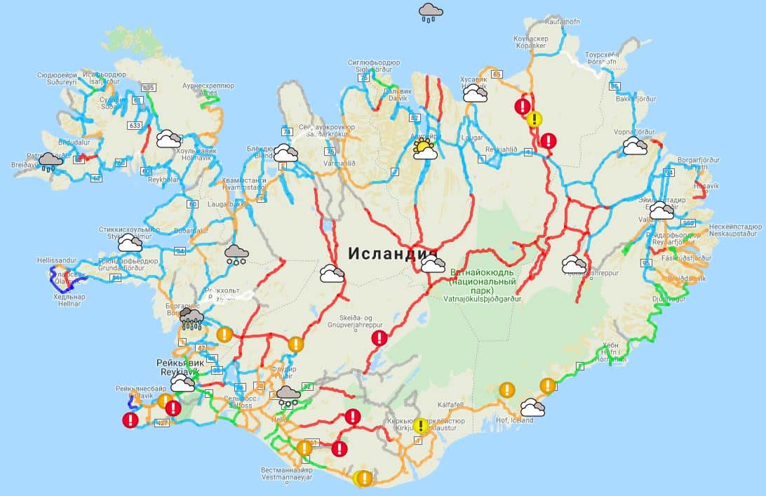
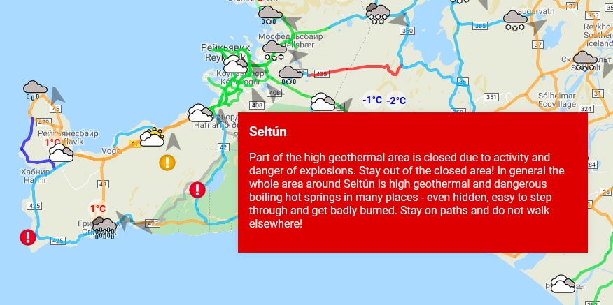
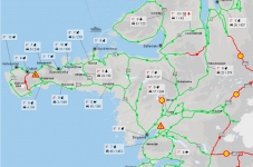
But that's not all, because now the site has a map of roads and their condition in real time safetravel.is/conditions . This map not only shows the condition of the roads, but also there are marks about the weather in the region, the wind. If you zoom in on the map, you can view current photos of the area.
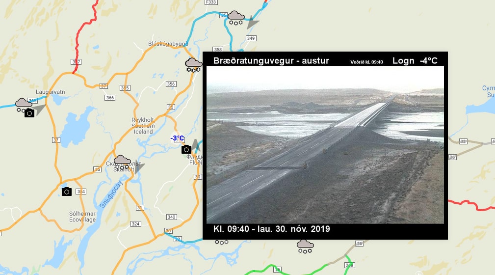
When you click on various icons on the map, descriptions and warnings appear, as well as information that roads or places may be dangerous or closed.
The purpose of the new map is to increase the safety of tourists. At the official presentation ceremony of the map, the Minister of Tourism, ÞÓrdís Kolbrún, called the map a big step towards the safety of tourists in the country
The new map greatly simplifies access to tourist information. This is important in a country where travel conditions can change very quickly. But don't forget that sometimes there may be no connection in the highlands, so it's worth checking the forecasts in advance.
Important information for tourists going to Iceland. Read about the features of movement and roads in Iceland in the article:
Roads in Iceland - everything you need to know
Iceland seems to be created for car tourism, and you can drive a jeep to any point where a dirt "path" leads. The most intere...