The Dyrholaey Peninsula is a former island of volcanic origin created by an eruption thousands of years ago. The popular tourist village of Vic is famous for its black sand beaches and proximity to Cape Dyrholaey and a naturally formed arch in the rock.
- The Arch of the Dyrholaey
- Where is Cape Dyrholaey?
- GPS coordinates of Cape Dyrholaey
- Cape Dyrholaey Lighthouse
- Is Cape Dyrholaey always open?
- How much does it cost to visit Cape Dyrholaey?
- What else can I see nearby?
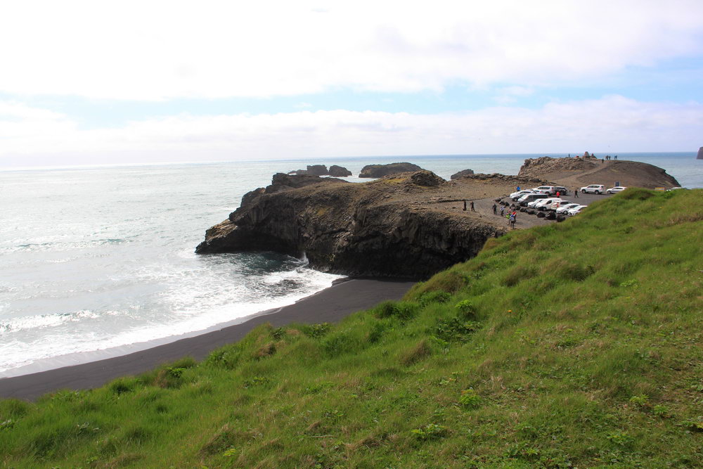
Dyrholaey is a small peninsula on the southern coast of Iceland, it is famous for its outstanding natural rock arch. From Cape Dyrholaey there are wonderful views of the black sand beaches around the village of Vik, the black basalt columns of Reynisdrangar and to the north, where the mighty Katla volcano sleeps on the Myrdalsjokull glacier.
On a clear day, almost the entire coastline west of the Dyrholaey is visible almost to the village of Selfoss.
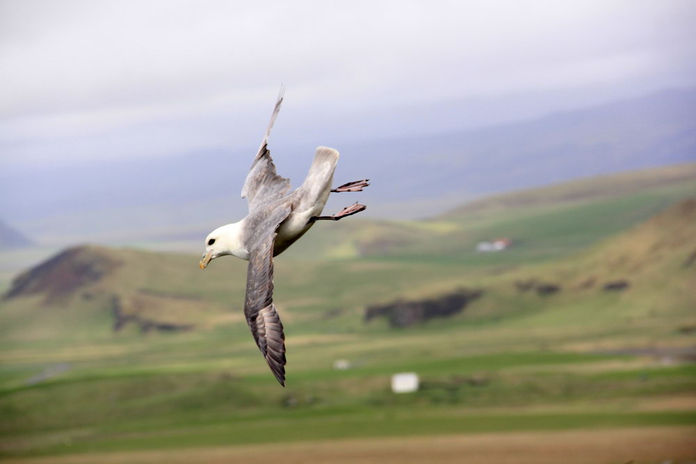
Cape Dyrholaey is also a bird sanctuary. Every year, thousands of visitors and bird lovers flock there to see puffins in their natural habitat. In summer, thousands of puffins build their nests on the grassy slopes of the Dyrholaey. The Dyrholaey Peninsula can offer excellent photo opportunities. Please note that Arctic terns also build their nests on rocks, and they can be very aggressive, so we recommend being careful.
Usually cape Dyrholaey is included in most of South coast tours, even 1 day from Reykjavik.
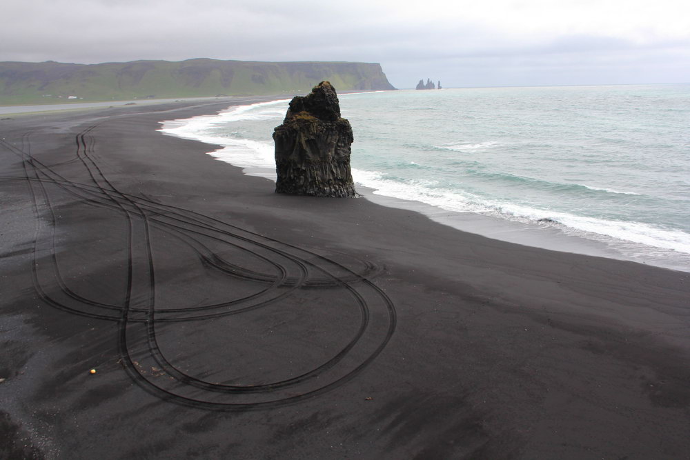
One of the most vivid impressions can be a walk along the beach with black volcanic sand. The waves rolling ashore are impressive, but be careful, the waves can become dangerous. Accidents occurred in the area of the Dyrholaey rocks when the wave overwhelmed and washed people off the rocks. Although some surf there, the tides and currents can be very unexpected and tricky, and we strongly advise you not to go into the water. And don't forget to look around - there are usually a lot of seals around Cape Dyrholaey.
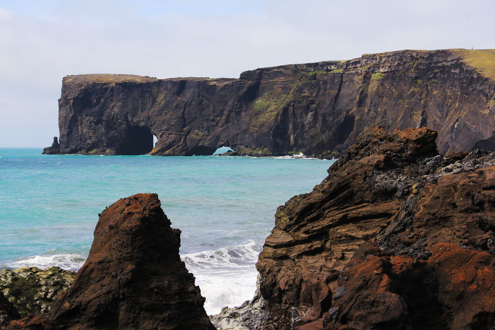
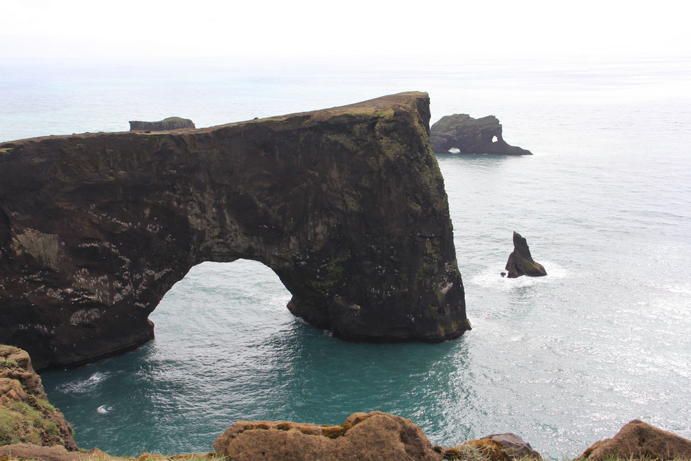
The Arch of the Dyrholaey
The name Dyrholaey means "island on a hill" in Icelandic. The reason for this name is that the arch is so large that ships and even small planes can pass through it.
The arch consists of basalt, the middle part was destroyed by sea waves and as a result an arch about 120 meters high was formed.
Where is Cape Dyrholaey?
Cape Dyrholaey is located on the southern coast of Iceland. When driving along the ring road east of Reykjavik, Dyrholaey is located right in front of the black sandy beach of Reinsfjara and the rocks of Reinisdrangara, near the village of Vik. The trip there directly from Reykjavik takes just over two hours (175 km).
However, the road that leads directly to the cape is marked F, but you can always use the second road available for all types of cars, and then walk along the coastline to the lighthouse.
GPS coordinates of Cape Dyrholaey
GPS: 63.3995957 N, -19,126898 W
Cape Dyrholaey Lighthouse
At Cape Dyrholaey you will find a century-old lighthouse. Not everyone knows that this is not an ordinary lighthouse. Inside, it has been renovated and turned into a private luxury hotel. Nevertheless, the appearance remains the same as it once was! This makes it a popular tourist attraction for photography among travelers.
Is Cape Dyrholaey always open?
No. Visitors should be aware that Dyrholaey is closed to the public during the bird nesting season, that is, partially in May and June. Therefore, we recommend asking the local information center about the status before heading to Cape Dyrholaey at this time.
How much does it cost to visit Cape Dyrholaey?
Entrance/entry to Cape Dyrholaey is free.
What else can I see nearby?
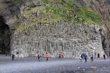
The black beach of Reynisfjara and the columns of Reynisdrangar, Iceland
The sand can be not only yellow or almost white, but also completely black.
Reynisfjara beach is formed by absolutely black volcanic sand - an unforgettable s...
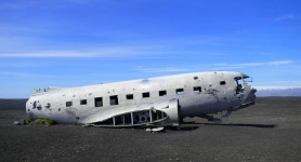
Remains of a DC-3 aircraft in Iceland
The plane crash site on the deserted sandy beach of Sólheimasandur is one of the main "non-natural" tourist attractions in Iceland.
...